
The hike was 3.2 miles with a 2900 foot gain in elevation. The first couple miles were absolutely gorgeous. The forest floor was covered in needles from the pine trees and the trail continually switched back up the mountain, but didn't get too steep, for the most part. Once we started getting higher, it felt like we were walking through a jungle. There were trees a bit off the trail, but mostly smaller ones, and the sides of the trail were very overgrown, enough so that they practically covered the trail. When we finally got out of that, we started heading up a steep slope. We finally got to the top and noticed a group sitting there, so went over to chat. They were with the forest service and were up there to work on a section of the trail. They claimed the trail kept going, so we headed off.
We kept hiking up the mountain, crossing snow, until we got to a steep slope. We could see the trail up the slope, so kept heading up. A section of the trail was washed out from a mudslide. We scrambled up to the next section of trail and kept going. There was another section that was washed out! We decided to just call it good from there. That's the point where I took the first photo. It was super steep! We walked down the trail until we got to where it was washed out again, then went straight down the mountainside to the lower trail and kept going from there.
We eventually learned that the technical end of the trail was the lookout where we saw the group of forest service workers. Though on our walk down, they were working on one of the steep sections of trail. It was a huge mud pit. I just about fell in trying to balance on the rocks they were putting there. They were working on diverting the water off the trail and putting rocks on the trail.
We made it back and the RV was in the shade... Of course. We did get enough power for another day or so though, so we headed back to where we stayed for those couple days earlier in the week. The cats were happy to get to go out again.
This morning, we heard thunder, so knew a storm was probably coming. We got everything packed up in case we had to leave, but let the cats run around outside still. Now it is pouring and poor Curly and Pickles are under the RV because they're too afraid to get in the RV. Once the rain lets up a little again I think I'll try to get them again.
-Miranda
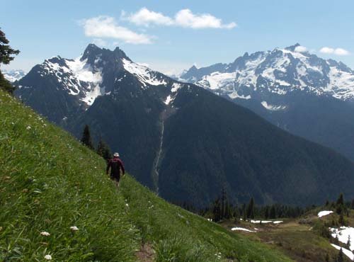
The top of the hike.
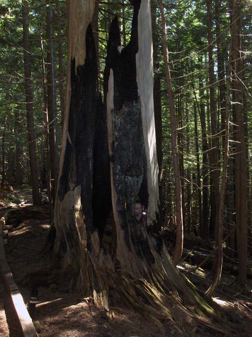
Joe in a very cool looking tree along the side of the road.
[ add comment ]
Joe, Sarah (a friend of Joe's) and I all went camping on the mainland of the Apostle Islands from Thursday to Friday. The weather on Friday was pretty much perfect. A nice temperature to not get too hot, but not get too cold either. Parts of the trail were very muddy though. The campsite is a 4.5 mile (so they say) hike from the parking lot. Unfortunately, it's a lot of up and down, but it was still fun. We reached the campsite around 4:30 and started working on dinner. It was really windy by the lake, so that was chilly. After dinner we hung out in the tent and played Bananagrams.
The only sleeping bag Sarah had was one only rated for 55 degrees.... Needless to say, it was colder than that. Joe kindly gave her his sleeping bag and he slept in hers. He was pretty cold most of the night.
We woke up to a chilly, cloudy morning. It got a little better as the trail moved away from the lake some. I got a few blisters on my feet the first day, but mole skin really helped that for the hike back. When we got to the swampy section (last half mile or so) it got hot! It was so weird. You could definitely tell when the breeze was coming from inland or from the lake. The inland breeze did not help one bit.
I can't speak for Sarah, but Joe and I are definitely sore.
-Miranda
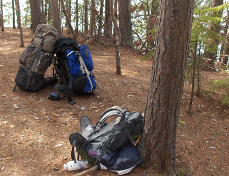
Our packs during our rest.
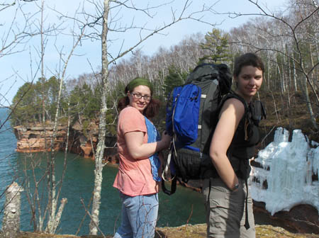
Sarah and I hanging out before heading out again.
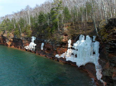
Ice still hanging on to the edge of the sea caves.
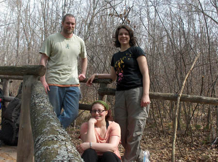
The three of us on our last leg of the hike.
[ 1 comment ] ( 11 views )
Yesterday Joe's friend, Scott, and Scott's cousin, Adam came out and we all went to Meyer's Beach to walk to the Sea Caves. I've never been out there in winter. There was a lot of really neat things. I, being an idiot, forgot my camera. So no pictures. :( Sorry. We did walk about 7-8 miles. So, that was quite a walk, and there were tons of people there, but it was still neat.
-Miranda
[ 1 comment ] ( 5 views )
We drove to Sequoia National Park and went to see the second largest tree in the world, General Grant. We then decided to head to the Redwood Mountain Grove which has many large trees. Unfortunately, there were 2 hiking loops that were both 6 miles long. We chose one that looked interesting and took that not really expecting to do the entire loop. We saw some huge stumps from an old logging camp, the Hart Tree, which is one of the largest sequoias, and Fallen Goliath, which was a huge sequoia that feel down a long time ago. I assume at least a couple hundred years ago. We did end up doing the entire loop which was a bit painful after our many miles from the last couple days. However, we did get to see a momma Black Bear and her three cubs. They were across a creek from the trail we were on which was nice. I felt no need to meet one on the trail.
-Miranda
CLICK FOR VIDEO:Hart Tree
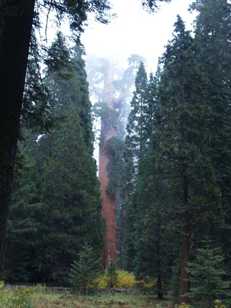
General Grant. This tree is about 40 feet in diameter and the second largest tree in the world (by volume).
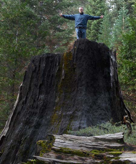
A very large stump from when a logging camp was there many years ago.
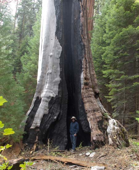
A large, dead, burned out sequoia.
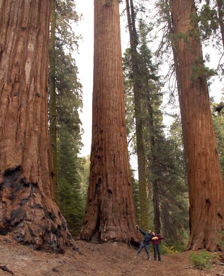
There were places were there would be a number of large sequoias near each other. This is part of the trail. Joe and I were basically in the middle of the triangle (so the tree on the left is actually slightly in front of us)
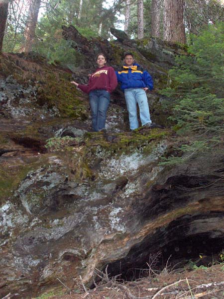
Toan and I standing near the roots on the Fallen Goliath.
[ 2 comments ] ( 12 views )
We decided to go for a hike and camp in the wilderness today. We got a wilderness permit (free) and packed up our packs to hike up to El Capitan. The guy at the place that gave us the permit said it was about 8 miles (one way) with an elevation change of about 3000 feet. We hiked for about 4 miles, had lunch, then kept on going up the steepest part of the hike. We only made it another two miles to where it flattened out before we decided to just make camp. Plus, the sign at the start of the hike said El Capitan was 10 miles away, not 8. We dropped our stuff off at camp and Joe and I decided to see if we could make it to the mountain. Well, we did... but it was another 4 miles... one way. We just about doubled our hike. The view was awesome, but we were hurting pretty bad by the time we got back to camp where Toan was sitting waiting for us with a fire going. Dinner sure tasted good.

-Miranda
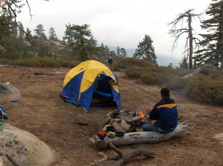
Our camp. Toan is trying to warm up by the fire while Joe's working on getting dishes clean enough for breakfast.
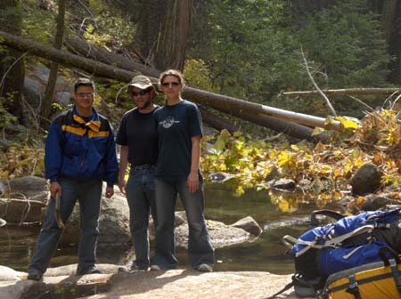
Our break spot by a stream on our way back.
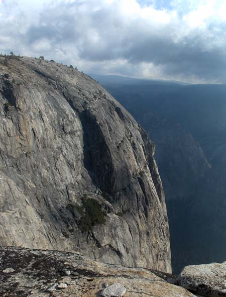
El Capitan from the top. Joe and I didn't hike all the way out, or even onto, the mountain. This view was pretty spectacular. The valley was huge!
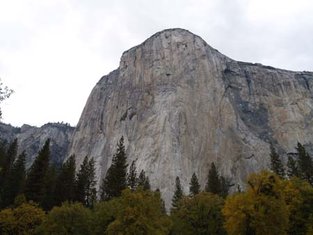
El Capitan from the ground in front of it in Yosemite Valley. Where we were standing the day before is just to the left in the photo.
[ add comment ]
Back Next
 Calendar