Anyway, the trail took about 45 minutes, all downhill, to get to Batad. A small village that appears to only be reached by trail. There were little shops and restaurants there. The terraces were gorgeous. After a short break, we started the hike through the terraces. We got to actually walk through them, which was very cool, though a little freaky at times. You would be walking along an edge that was only about a foot wide. Muddy rice patty on one side and a 20 foot drop off on the other side into another rice patty. The stairs were skinny and really tall. Let's just say there could have been twice as many stairs everywhere on this trail. So hard to take such huge steps.
We made it to an upper lookout where we then started going down a lot of steps eventually to a little hut. Sandra decided to stay there while we went farther to the waterfall. That turned out to not be the best idea. Super steep to get to it and we were already pretty tired and super sweaty by this time. Joe and I did go swimming, which felt amazing. Unfortunately, we were so hot and sweaty again by the time we got back to Sandra that it really negated the whole waterfall swim. It was still pretty neat though.
We were going to originally go through the village (you can see in the middle of the terraces near the bottom) but we asked the guide if we could just take the 'middle road' which would have the least amount of elevation change.
We ended up getting back to Banaue around 4pm. Our overnight bus was leaving at 7, so we paid for a shower (which we severely needed), had dinner then got on the bus.
The bus was awful. Since we were in the mountains, it was constantly going back and forth, which was annoying anyway, but then they were randomly picking people up until at least midnight. It got to the point where people were standing in the isle, which, when you're trying to sleep, is annoying. They keep bumping the seat, or are standing right next to you, which is sort of creepy. I had gotten maybe a few hours of sleep. Joe and Sandra got barely any though. We got to Manilla at around 5am. From there we eventually found a bus that would get us close to the airport. We hopped on that, where Joe managed to get another hour of sleep. We got off in Dau where we got a tricycle to a jeepney area. Then we took a jeepney to the airport. We were about three hours early, which wasn't too bad.
The flight was just under 4 hours, but we ended up having to circle for about 15 minutes because of too much air traffic. We finally landed, then got to immigration, where there was an insanely long line. Unfortunately, they had two lines (which is weird, inefficient, and kind of dumb) and of course we picked the wrong line... We ended up waiting in line for an hour and a half. We got our luggage, walked through customs, and caught a bus to Chinatown. We finally made it to the hostel in Kuala Lumpur at about 7pm. Yes, that means we traveled for 24 hours....
-Miranda
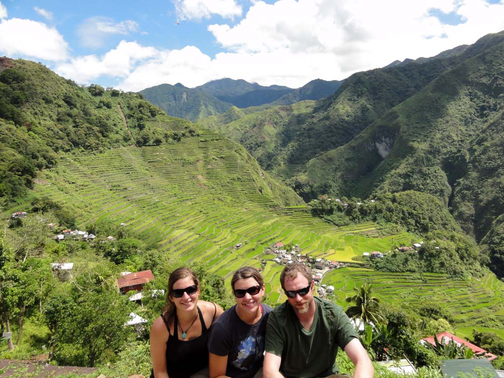
Joe, Sandra and me in front of the Batand Rice Terraces. (Click to enlarge.)
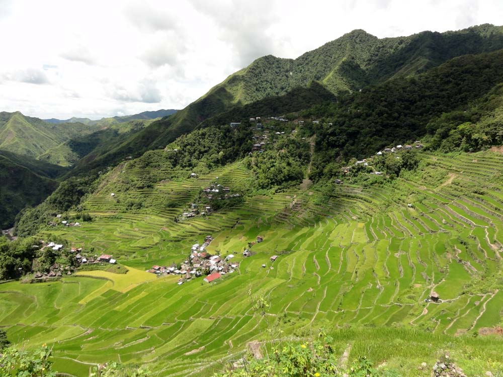
View of the terraces. (Click to enlarge.)
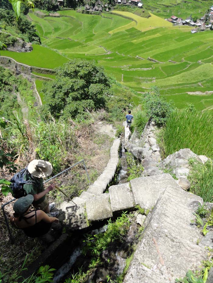
Some of the stairs down. (Click to enlarge.)
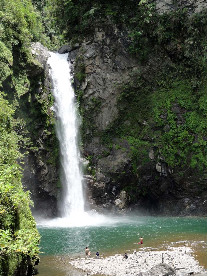
Waterfall at the end of the trail. (Click to enlarge.)
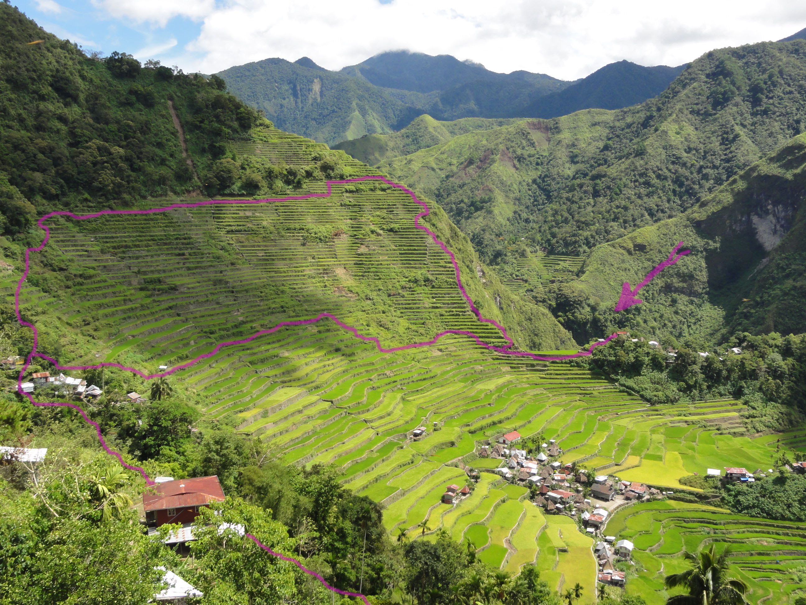
The approximate path we took through the rice terraces. (Click to enlarge)
[ 11 comments ] ( 48 views )
We spent the following day working and relaxing around the hostel since it was raining. However, on Wednesday, we headed back out for a hike. This time, we went down a different staircase and worked out way back to the "Great Staircase". The walk was gorgeous with some pretty waterfalls along the way.
There is a veggie and fruit shop next door where the prices don't seem too bad. We found dinner of gnocchi and veggies, which turned out super delicious.
Today, we decided to take the train to Blackheath. From there we walked about 7k down a road to a spectacular look out. We had heard the "hanging rock" was there, so we searched for that, which was just a short trail away. We climbed out onto it to get an amazing view of the valley. A bit freaky, but very neat. The walk was tiring, but we finally didn't have to walk up or down any stairs.
We were thinking of going out for dinner, but then Joe mentioned making nachos. So, we found corn chips (surprisingly, Doritoes makes plain, salted chips), some beans, cheese, lettuce, olives, an avocado and a tomato. They were super yummy. :D
-Miranda
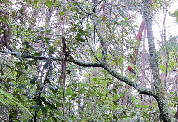
A better photo of the same type of parrot.
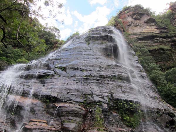
Purty waterfall.
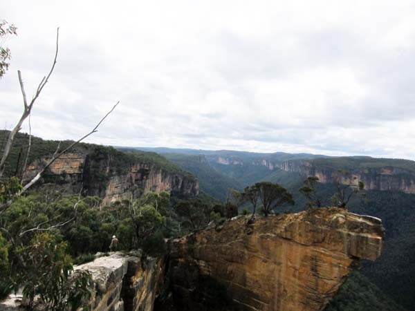
The hanging rock. Joe is on the left. Unfortunately, I didn't get any good photos of it since I can't see what I'm taking a photo of.
[ 2 comments ] ( 6 views )
This morning we got up, packed and headed for Central Station. We rode the train to Katoomba and found a hostel to stay at. Unfortunately, their private rooms were all booked, but the dorm we're in is really quiet. Their internet is free and they have free breakfast in the morning, so that will be a nice change.
Once we got set up, we headed to Echo Point where the start of walks into the valley and into the national park are. The hike really wasn't long, but you had to walk down stairs that went down the valley wall. They were super steep. There were apparently 900 steps. That was just going down. The trail was very pretty and had a view of a gorgeous waterfall.
From there we reached the place to head back up the valley wall. We could cheat and take the sky tram, but we decided to take the Furber Stairs instead. There were some beautiful sites along the way, so even though it was pretty tough, we're definitely glad we went that route. Along the trail we ended up seeing a few parrots. They were bright red with blue on the tail, head and wings. We also got to see (and hear) Black Cockatoos. Very fun.
After we completed the hike (it took us 3.5 hours), we headed back into town to find dinner. The Thai restaurant we found was very good. They didn't include rice with their meals, which was a little odd, but it was still delicious.
-Miranda
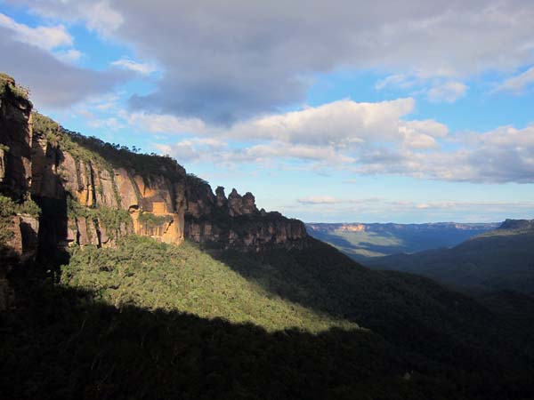
A view of the Three Sisters. They're a main land formation in this area of the park.
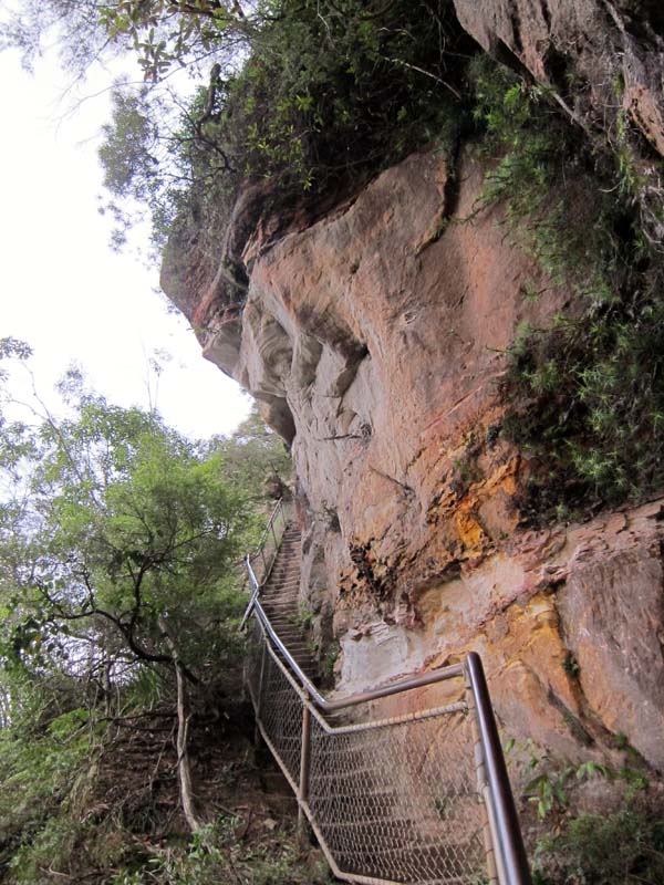
A small section of the stairs on the way back up. Some of the stairs were metal, but most were carved directly out of the stone wall.
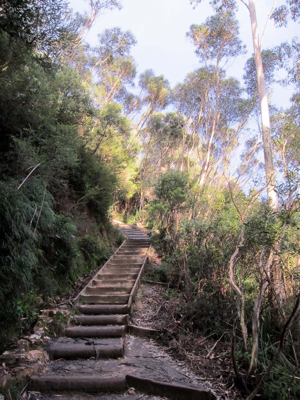
Some more stairs. If you click on the photo and then look near the patch of sunshine, you might be able to see two red spots. Those are parrots. ;) That's what I get for breaking my camera.
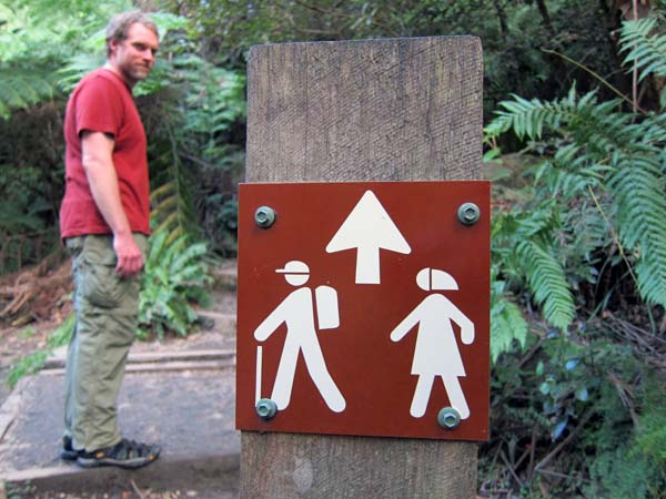
An amusing sign telling us which way the trail goes.
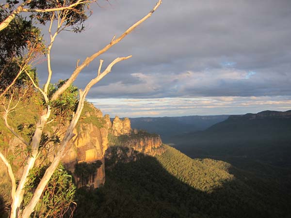
Another view of the Three Sisters while the sun was working on setting.
[ 2 comments ] ( 7 views )
After the library, we headed towards a campground in Totaranui. It's huge! It can fit 850 campers, or so the DOC book claims. We had a relaxing evening and decided to do a section of the Abel Tasman coastal hike the next morning. One option was the whole loop, which would have been around 20k, part of it going up to around 450 meters. Otherwise, we could hitchhike to the start and hike back to the campground.
We found a ride pretty quickly, so we started hiking. It was a bit more up and down than I was expecting, but it was still a very nice hike. Most of it was in the forest and it had some great views of the coast and some beaches. We made the hike in 4 hours. It was around 13k total.
From there we headed back into Takaka to use the library's internet for an hour. Our goal from there was to maybe get to a free DOC site, but it was looking a little far and we were due for a shower, so we stopped in Motueka at a holiday park and are staying here for the night. It's super packed because the fruit pickers of the season are here, but a shower is definitely nice.
-Miranda
[ 2 comments ] ( 2 views )
We woke up this morning to frost and ice covering the windows... We had purchased hats and gloves the day before just because information on the hike we were going to do mentioned you should have them. We figured we would probably need them on the South Island anyway. Boy are we sure glad we picked them up. In the middle of the night we had to put the hats on to keep so much heat from escaping out of our heads.
Our plan for the day was the Tongariro Alpine Pass. It's a day hike that typically takes 7-8 hours. It's 19.4 km (12 miles) with about 2500 ft up and 3600 feet back down. When we arrived at the parking lot, there were a lot of people there. Some shuttles (read buses) pulled up not long after us, so we tried to get started before them. The train of people was pretty crazy, but through the hike, we did manage to space out a bit.
We definitely saw the inspiration for Mordor and got to see 'Mount Doom' up close. The walk back down was quite painful on the knees, but the hike was great. There were beautiful sites along the way, including some 'emerald lakes'. Unfortunately, my camera's battery was basically dead, so I didn't get to take nearly as many photos as I wanted to, but maybe that was a good thing in the end. Now we can say that we have walked through Mordor. :D
Here's a link to a map of the hike: http://www.tongariroalpinecrossing.com/
-Miranda
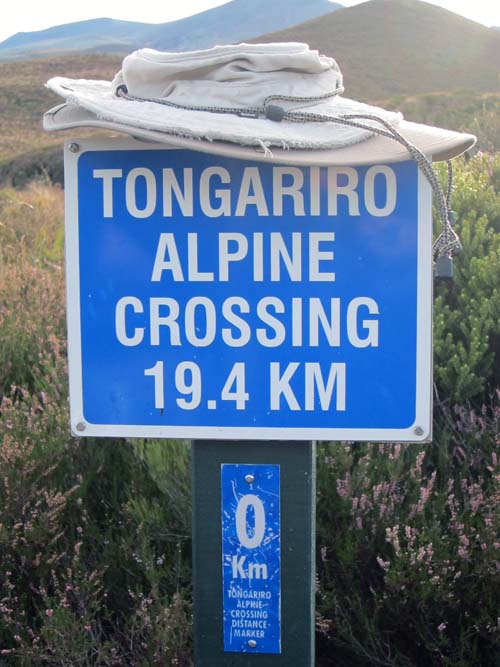
Start of the hike.
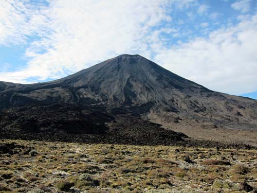
Mt Ngauruhoe ('Mount Doom')
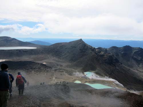
Emerald Lakes.
[ add comment ]
Back Next

 Calendar