-Miranda
We saw a few deer and a strange wildflower I had not remembered seeing? turned out to be a "Heal-all". Trailhead was near: 47°58'51"N 91°58'59"W
-Joe
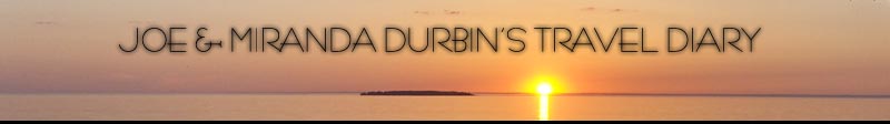
A wetland area we passed. Odie is in the water.

[ 1 comment ] ( 1 view )
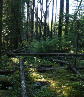
Joe and I drove up to the Boundary Waters to hike up Eagle Mountain, the highest point in Minnesota. It was a nice 3.5 mile hike. Busy weekend though, we passed quite a number of groups along the way. After the hike we decided that we would drive to his mother's house instead of going home. Along the way we saw a Ruffed Grouse and her babies, Ravens, and a cute baby coyote. The most excitement was when we almost hit a moose! Unfortunately we were unable to back the car up to try to get a picture.
-Miranda
We also updated our Fell in River, Broke Camera entry with some pictures off of the fixed camera below! Eagle Mountain is @ 47°53'51"N 90°33'39"W
-Joe
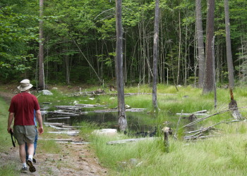
Joe and I on top of Eagle Mountain.
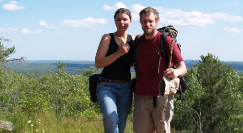
The view from top.
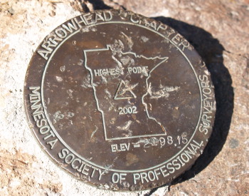
There was a plaque at the top as well as this marker.
Even after 7 years since the wind storm in the BWCAW, there is still evidence that it occurred.
[ add comment ]
Friends of Joe's, Toan and Thang, came up from the Cities for the day, so we all went up to Soudan to check out some bat caves and go for a little hike. We didn't see any bats, but the three caves we checked out were neat. We were toasty after the hike so we went to an old mine pit nearby to swim. There's a nice cliff there that you can jump off of at many different hieghts. We all went off at least once.
-Miranda
Afterwords, Toan, Thang, Tim and I went out into the woods behind the house and had a Campfire Dinner.
P.S.
Caves Near: 47°49'18"N 92°13'56"W
Nice Cliff Pit: 47°48'35"N 92°15'52"W
-Joe
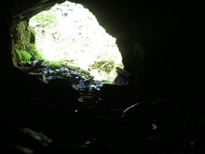
A cave we explored.
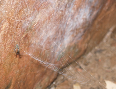
A spider we found near the end of a cave.
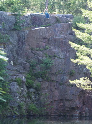
The 'cliff' we jumped off of. The ledge is almost halfway up on the left side of the photo.
[ 3 comments ] ( 13 views )
Miranda and I paddled an unpopulated stretch of Lake Superior Harbor today. We put in @ 46°41'24"N 92°8'49"W. Nice 3-4mile paddle that started in a swamp and went out into the bay. Found a hidden unmarked campsite @ 46°42'4"N 92°9'46"W. Our general path is shown in purple on the satelite map below.
-Joe
Joe and I saw a frog as soon as we got out of the car. Other animals we saw were deer, a porcupine, Canada Geese, Turkey Vultures, a Belted Kingfisher, and yet another Great Blue Heron. The birds were very noisy also, but I'm a bit rusty on my bird calls.
Here are some pictures with my new camera:
-Miranda
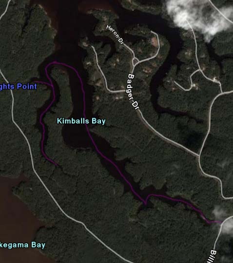
satelite map showing the path we took in purple.
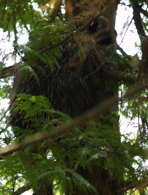
The porcupine climbed into the tree while we were there, so I got out to take some photos.
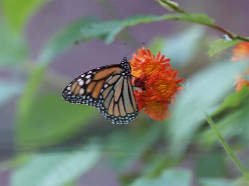
Joe's wonderful butterfly picture.
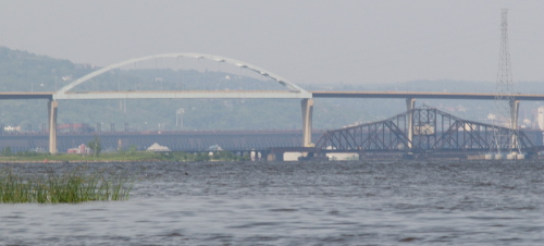
The Bong bridge and the old bridge below.
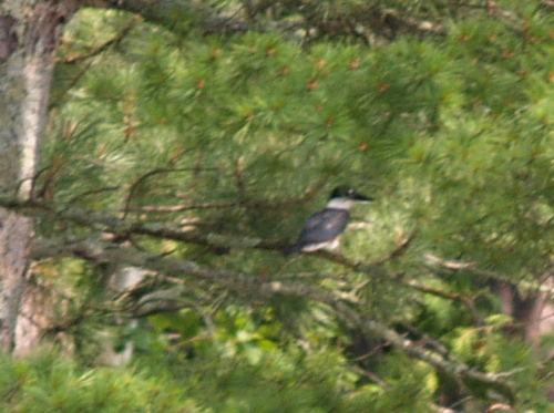
The Belted Kingfisher. He was far away, so this is the best picture I could get.
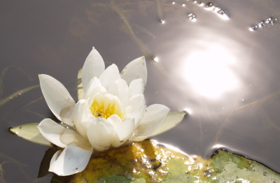
A lily pad flower with a bug on its petal.
[ 3 comments ] ( 9 views )
Miranda Just got her Graduation/etc.. Present. A Low-end Digital SLR Camera. Talk about complicated and expensive!! She's been enjoying taking pictures though, and this should improve the quality of critter shots imensely. Hope to get out tomorrow and test it out!
Olympus E-500 - Digital SLR
-Joe
[ 1 comment ] ( 3 views )
Back Next
 Calendar