
After 4 agents searched our Entire Camper for half an hour, They head agent told us to turn around!!!
I Tried to find ways around, and "lightly" argued (didnt want a cavity search) and gave a fat lip for 20 minutes.
She eventually changed her mind... They were worried since we had winter clothes, etc..
and all of our gear, she said she believed we weren't going to LEAVE!!!
After about 3 hours, we sped off with our "permit", which says we have to be out by the end of august.
FOund a great spot right off hwy 71. went searcing for a lake to swim in,
ended up biking 15 or so miles until we found a great little spot down an
abandoned road. little chairs and a private little lake.
-Joe
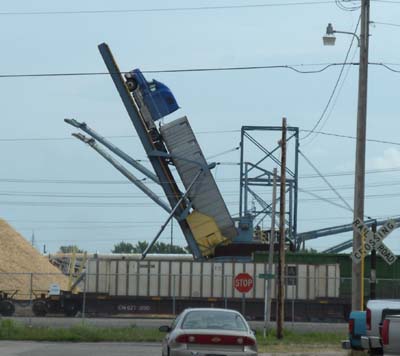
We saw this in International Falls.. Apparently it's how they dump the grain out of the trucks?!?
[ add comment ]
I noticed interesting terrain on Google Earth so we drove over to it. Found out it was a huge burn-down over a strange sandy-bog..
We stopped for a swim at a public park on Lake Superior past Ontonagon. It looked just like Park Point. Afterwards we stopped right next to the Big Iron River and watched the begining of the sunset before heading back south away from The Lake.
For the night we stayed back at the same sandpit we had stayed at on our second night.
-Joe
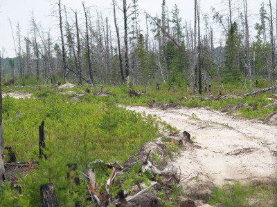
The burned sandy-bog.
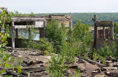
A large, old, burned-out building we stopped by.
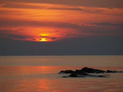
Sunset by Big Iron River.
[ 1 comment ] ( 11 views )
Woke up in our nice hidden unused sandpit.. Miranda wanted to spend the day here...
I'm pushing for a little better "view"
 [46 39'34" N,89 35'53" W]
On the road, we went through a construction site where they're working on the highway.
There was a red Dodge Viper parked off the road in the middle of the work site!?!
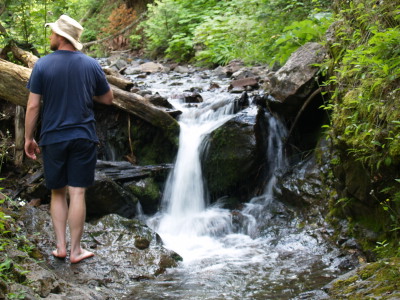
Checked out Jacobs Creek Falls, climbed up the river a quarter mile.
Went Snorkeling at an awesome swimming beach, nicer than Park Point! [47 26'36"N 88 13'0"W]
Not much other than sand, and a couple rocks.. . Clean perfect sand.
Afterwards, we managed to find internet access in Copper Harbor, which was a surprise since it is
a tiny little tourist trap. They wanted $3.56 for gas ($3.16 avg out here).
Camped out on the side of a road right past Copper Harbor.. We gave up searching for a better spot,
nice view, but we may get asked to leave.. [ 47°27'46"N 87°49'32"W ]
-joe
FLYS!!!! CANT SLEEP BECAUSE OF FLYS!!!!! HUNDREDS OF FLYS!!!
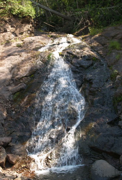
Jacob's Creek Falls.
Farther up Jacob's Creek Falls. It was quite pretty.
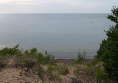
The beach we had lunch at. That's me (Miranda) with the pink flippers in the water.
[ 3 comments ] ( 16 views )
We went snorkeling at a rocky beach on lake superior [46 36'44" N,90 19'59" W]
had a nice dinner in the parking lot (conveniant!) and then Slowly drove down by the spooky-dark
yet traversable forest floor. Very nice roads so far, small, but good condition.
Stopped for gas, 20cents more expensive in Michigan!! (SAM!!!) ouch. should
have filled up in Wisconsin... We tried a new technique for finding a "hobo-spot", one of us rides her bike down small roads quick while i sit on the shoulder. Saves gas, and prevents the beast from getting stuck.
-Joe
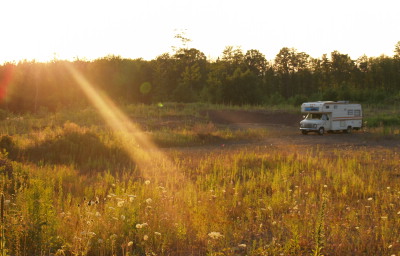
Our sandpit we stayed in that night.
[ 1 comment ] ( 9 views )
We spent the morning in Bayfield. Rode our bikes around a bit,
Thought about scuba diving here, they have some cool wrecks,
but all the coordinates are in LORAN!!?!? something ancient and not
equivalent to lat/longitude, so we had no idea where the wrecks were..
TIme to move on though...
CLick on the CURRENT LOCATION link on the right.
We'll try to keep that updated. red spot marks where we last had internet
-Joe
[ 1 comment ] ( 5 views )
Back Next
 Calendar